Mesoscale Model Evaluation Testbed

MMET Case: 07 October 2009
Case Description
Reason for interest: high-resolution window performed worse than NAM
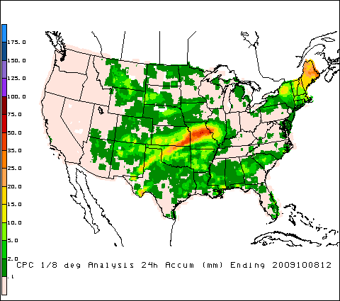
Isentropic lift over a cold dome of air initiated thunderstorms over the Texas panhandle, which later formed into an MCS and moved northeast across the plains into Missouri, bringing a great deal of rain in a swath from the Texas panhandle to western Illinois. Minimal severe reports were associated with this system on 7 October.
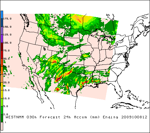
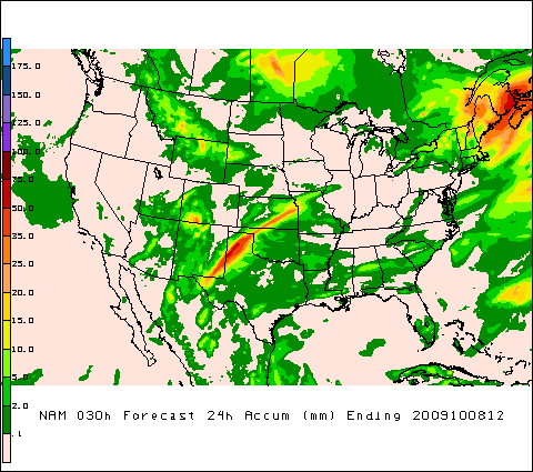
This day is particularly interesting because the NAM QPF performed quite well (although it did over-predict precipitation totals over the Texas panhandle) while the high-resolution window missed most of the eastern half of the precipitation event.
Go to physics suite configuration data
Observations:
NAM:
High-resolution window: