Mesoscale Model Evaluation Testbed

MMET Case: 17 December 2009
Case Description
Reason for interest: "Snowpocalypse" or North American Blizzard 2009
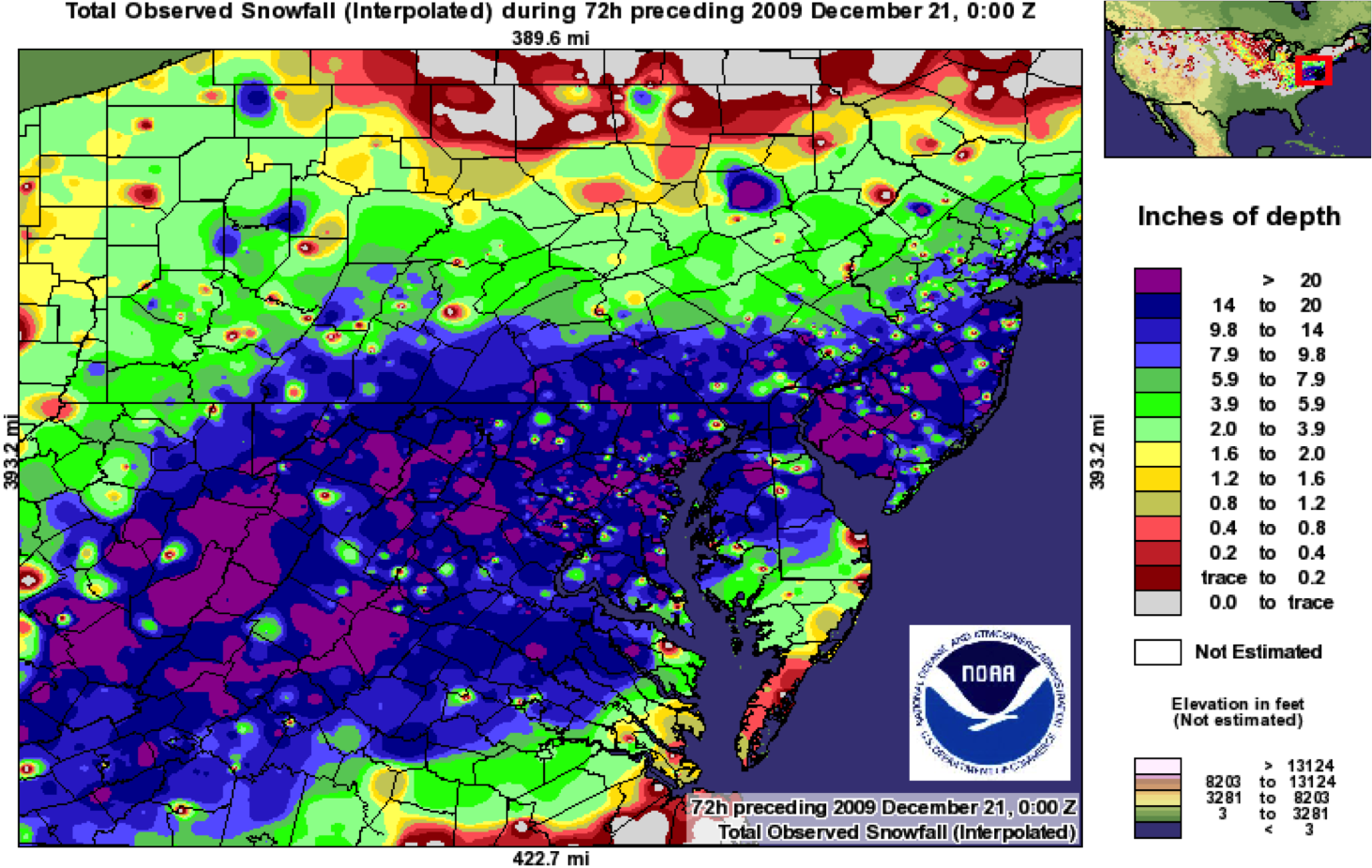
Snowpocalypse 2009 began on 16 December as a low pressure system in the Gulf of Mexico, moving northeast over the Florida panhandle and onto the East Coast. By 18 UTC on 18 December, heavy snow had begun to fall in western North Carolina. Abundant moisture was available due to the storm's placement and circulation, allowing for significant snow accumulations from North Carolina to Nova Scotia as the storm tracked up the East Coast. By 20 December, 23 inches of snow lay on the ground in Philadelphia while Brookhaven, NY measured 26 inches of snow. The storm was responsible for thousands of car accidents and even caused New York City to lose power.
Go to physics suite configuration data
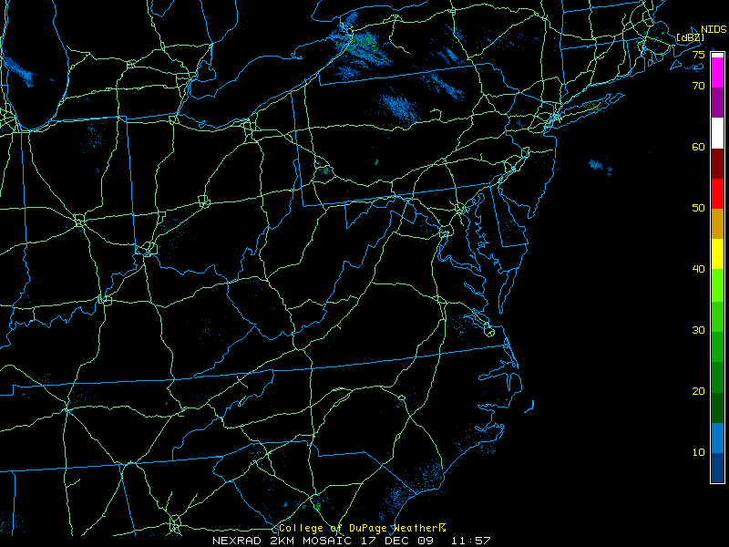
Radar loop of event:
Snow totals:
Overall, models performed quite well with this event. However, there were a few areas of concern:
1) Decreasing cloud top heights and slightly warmer air across central North Carolina were not captured by the NAM.
Observations:
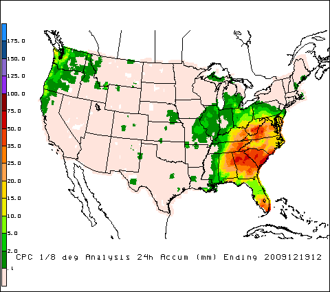
Model:
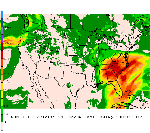
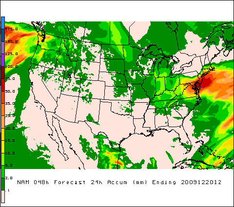
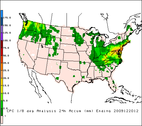
2) NAM QPF over the mid-Atlantic states was too high.
Observations:
Model: