Mesoscale Model Evaluation Testbed

MMET Case: 28 June 2012
Case Description
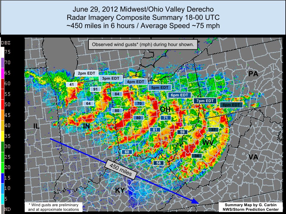
Reason for interest: Very strong, high-impact derecho.
A deadly, record-setting derecho on this day was preceded by major instability from the Midwest to the East Coast, with CAPE values exceeding 5000 J/kg and temperatures reaching above 100 degrees F. Elevated convection in northern Illinois moved into Indiana along a weak stationary front, assisted by an elevated mixed layer. Record temperatures, abundant moisture, and steep lapse rates aided further storm development to the south and east. A bow eventually formed along the squall line and wreaked havoc from Illinois over the Appalachian Mountains all the way to the Atlantic coast.
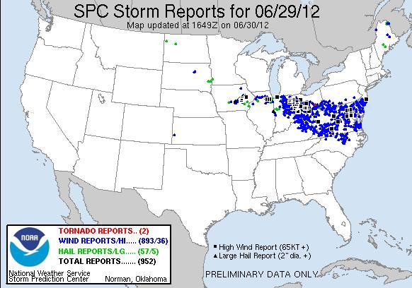
More than 20 fatalities resulted from high winds and falling trees, and over 4 million people lost power. There were 893 high wind reports for June 29th, 2012 with some reaching over 90 mph.
Go to operational baseline data
Go to physics suite configuration data
SPC Storm Reports for June 29th, 2012:
Storm Summary from NWS/SPC: