Mesoscale Model Evaluation Testbed

MMET Case: 5-6 January 2015
Case Description
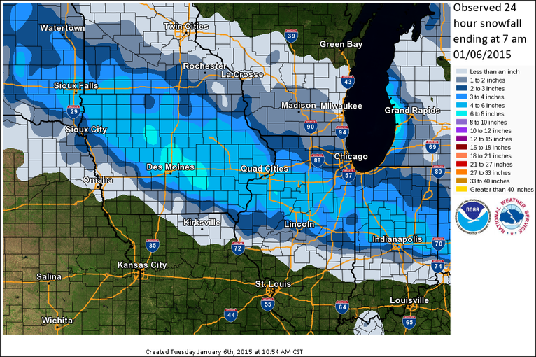
Reason for interest: Intense snowfall event.
This was a fast moving clipper type system resulting in a broader band of snow but very intense snowfall rates. This event was fairly well forecast by the operational models, including HiRes WRF and NMM - all predicted a band at least 48 h out. The location was somewhat uncertain. Total snowfall was 4-8" starting midday January 5th to early morning January 6th.
Go to operational baseline data
Go to physics suite configuration data
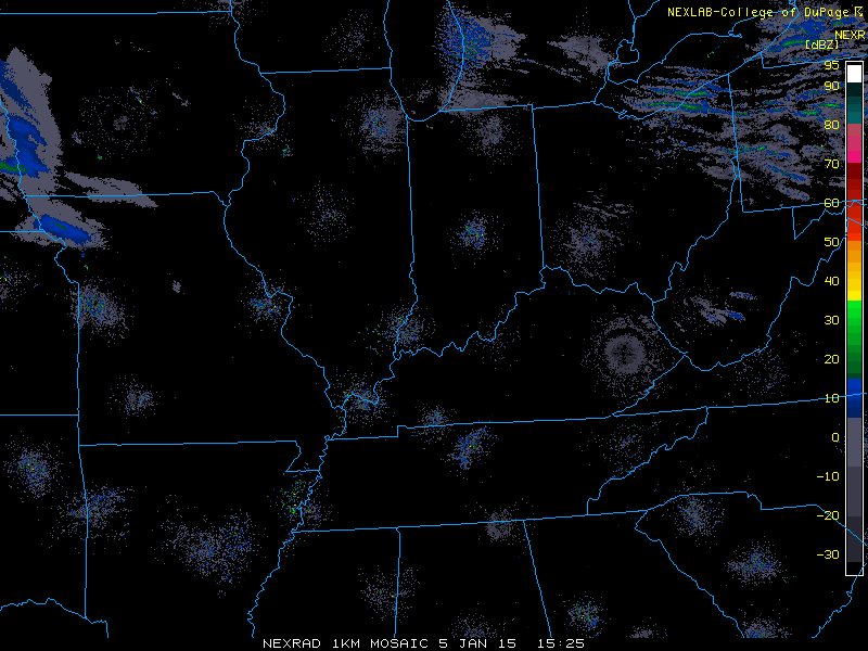
Loop of 1km radar reflectivity
Regional snowfall ammounts