Mesoscale Model Evaluation Testbed

MMET Case: 22 March 2015
Case Description
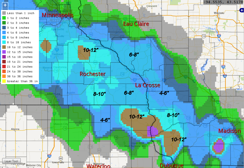
Reason for interest: Heavy banded snowfall event not well forecasted.
This was a narrow and intense band of heavy snowfall that extended from northeast South Dakota through southern Minnesota, and far southern Wisconsin. Maximum amounts were 10"+ in isolated regions of southeast MN. Temperatures remained near-freezing, which caused much of the precipitation that was forecast to fall as rain, fall as snow instead. This band was not as well forecast days in advance but there was evidence of banding at least 24 h out in the NMM and WRF ARW as well as in a couple of the larger scale models.
Go to operational baseline data
Go to physics suite configuration data
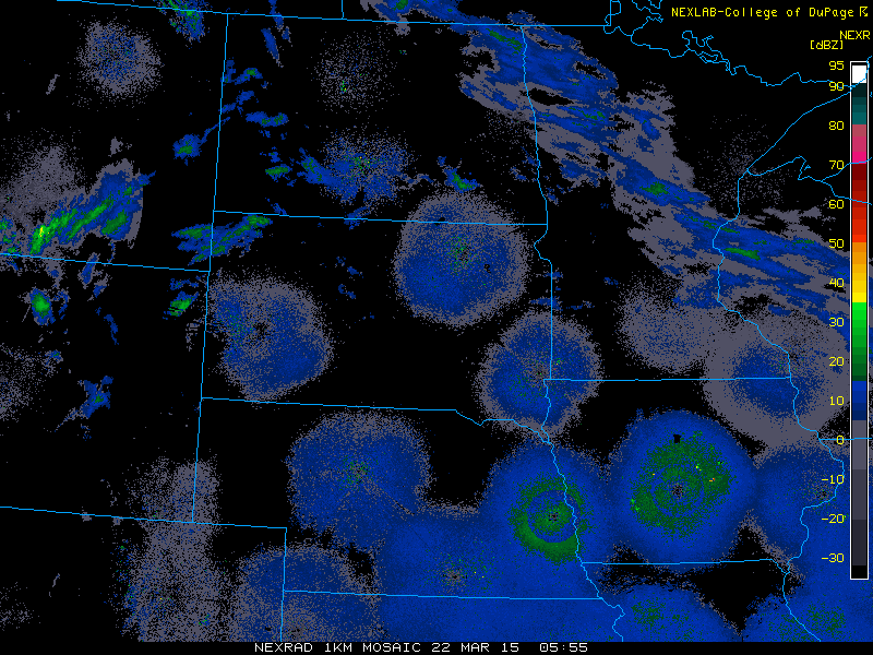
Loop of 1km radar reflectivity
Regional snowfall ammounts