
HWRF HC35/HDTR Forecast Comparison

HC35/HDTR Forecast Comparison Description
- Code
- Models
- Domains
- Cases
- Verification
- Archives
Codes Employed
The HWRF codes used in the HWRF HC35/HDTR Forecast Comparison Test were obtained from the HWRF code repository hosted by the Developmental Testbed Center, and from the external repositories linked from there. The versions of all codes have received minor updates since the HWRF v3.5a release in August 2013 but are still very comparable to the HWRF 2013 operational implementation.
Common code used for HC35 (control) and HDTR:
•WPS - tags/TNE_Thompson_MP
•UPP - tags/TNE_Thompson_MP
•GSI - tags/TNE_Thompson_MP
•Princeton Ocean Model for Tropical Cyclones (POM-TC) and
POM-TC initialization - tags/TNE_Thompson_MP
•NCEP Coupler - tags/TNE_Thompson_MP
•GFDL Vortex Tracker - tags/TNE_Thompson_MP
•National Hurricane Center Verification System - tags/
TNE_Thompson_MP
•hwrf-tne automation - branches/TNE_Thompson_MP r447
Code specific to HC35:
•WRF - branches/TNE_Thompson_MP_control revision 6889
•HWRF-utilities (atmospheric initialization, miscellaneous libraries
and tools) - branches/TNE_Thompson_MP_control revision 958
Code specific to HDTR:
•WRF - branches/TNE_Thompson_MP_thompson revision 6896
•UPP - local changes to output Thompson-related variables
•HWRF-utilities (atmospheric initialization, miscellaneous libraries
and tools) - branches/TNE_Thompson_MP_thompson revision 957
HWRF Model: Control (HC35) Configuration
Configuration similar to the 2013 operational HWRF but with gfs_alpha=0.7 in all domains. Physical parameterizations include Ferrier microphysics, GFDL radiation called hourly, GFDL surface layer, GFS planetary boundary layer, and Simplified Arakawa-Schubert convection.
HWRF Model: HDTR Configuration
Configuration similar to HC35 but with Thompson microphysics, and with RRTMG radiation called every four hours. Additionally, changes were made to the WRF and UPP codes to output additional fields.
Domain Configuration
The HWRF domain was configured in a similar way as the 2013 NCEP operational system. The atmospheric model employed a parent and two movable nested grids. The parent grid covered a 80x80 degree area with approximately 27 km horizontal grid spacing. The d02 domain covered a 11 x 10 degree area with approximately 9 km grid spacing. The d03 domain covered a 7.2 x 6.5 degree area with approximately 3 km grid spacing. The location of the parent and nests as well as the pole of the projection, varied from run to run and were dictated by the location of the storm at the time of initialization.
HWRF was run coupled to the POM ocean model, In the Atlantic, a three-dimensional configuration of the POM-TC was employed, while in the Pacific a column (one-dimensional) configuration of POM-TC was used. The POM domain for the Atlantic storms depended on the location of the storm at the initialization time and on the 72-h National Hurricane Center forecast for the storm location. Those parameters defined whether the East Atlantic or United domain of the POM was used.
The image shows the atmospheric parent (shaded) and nest domains (black outline) and the United POM domain (pink outline).
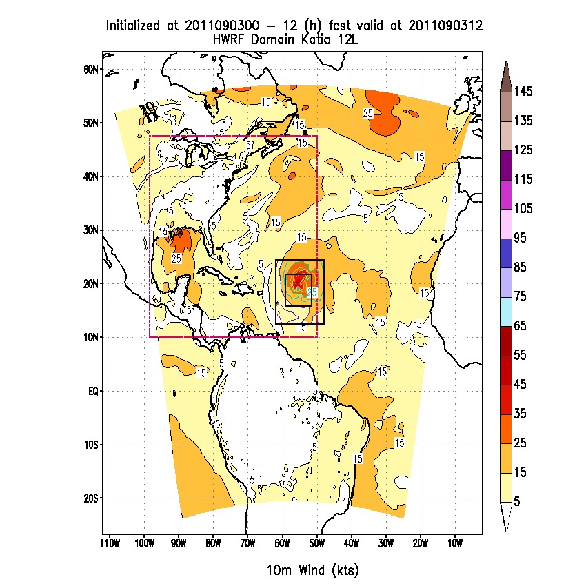
Click on the image to enlarge
Cases Run
• Storms: 31 storms from the 2012 season.
• 2012 Atlantic: Alberto, Beryl, Chris, Debby, Ernesto, Helene,
Gordon, Isaac, Joyce, Kirk, Leslie, Michael, Nadine, Oscar, Patty,
Rafael, Sandy, Tony
• 2012 Pacific: Carlotta, Daniel, Fabio, Gilma, Hector, Ileana,
John, Kristy, Lane, Miriam, Norman, Olivia, Paul, Rosa
• Initializations: Every 6 h, in cycled mode.
• Forecast Length: 126 hours; output files available every 6 hours
Verification
Large scale errors
In order to assess the quality of the large scale HWRF forecasts, the parent domain forecasts were compared against GFS analyses. Prior to the comparison, both fields were interpolated to a common domain of 0.25 degree grid spacing. Since the HWRF parent domain is in a different location for each forecast cycle, the common domain used was a superset of all HWRF domains used in the 31 simulated storms. This method allows for obtaining information over a broad domain, even though the number of matched pairs is spacially variable, and larger near the center of the domain.
The Model Evaluations Tool (MET) software was used to conduct this comparison. Evaluation was conducted for geopotential height, temperature, relative humidity, and winds. Levels include 1000, 850, 700, 500, and 250 hPa and metrics include bias and Root Mean Square Error (RMSE). In addition, differences between the biases, as well as between the RMSEs, of the two HWRF configurations, were computed.
Precipitation Verification
The precipitation forecasts for the 23 cycles run for Hurricane Sandy were compared against the Tropical Rainfall Measuring Mission (TRMM) 0.25 degree analysis using MET. Fields of 24-h accumulation of observed and forecast mean, bias, RMSE are presented, along with frequency bias and Gilbert Skill Score (GSS) for the thresholds of 0.254, 2.540, 12.700, 25.400, 76.200, and 127.000 mm.
Some of the results are displayed as two-dimensional fields, while others are spatially aggregated over three separate domains: full (entire parent domain), Sandy (entire observed Hurricane Sandy path), and Sandy local (around location of observed Hurricane Sandy Track at the valid time of the forecast).
Tropical Cyclone errors
The characteristics of the forecast storm (location, intensity, structure) were compared against the Best Track using the National Hurricane Center (NHC) Verification System (NHCVx - https://svn-dtc-nhcvx.cgd.ucar.edui/tags/TNE_Thompson_MP). The NHCVx was run separately for each case, at 6-hourly forecast lead times, out to 120 h, in order to generate a distribution of errors. Verification was performed for any geographical location for which Best Track was available, including over land. No verification was performed when the observed storm was classified as a low or wave.
An R-statistical language script was run on a homogenous sample of the HC35 and HDTR datasets to aggregate the errors generated by the NHCVx and to create summary metrics including the mean and median of track error, intensity error, absolute intensity error, and radii of 34, 50, and 64 kt wind in all four quadrants. All metrics are accompanied by 95% confidence intervals to describe the uncertainty in the results due to sampling limitations.
Tropical Cyclone Environment Errors
The errors in the Tropical Cyclone (TC) environment were assessed using the
A program supplied by R. Torn (U. Albany) was used to summarize those results, which were then plotted using a script in the R statistical language.
Archives
All archives are located in the NOAA Environmental Security Computing Center (NESCC) High-Performance Storage System (HPSS).
Input data files originating from the GFS are in directory /NCEPPROD/hpssprod/runhistory/rh2012/2012mm/2012mmdd. The relevant files are the IC in GRIB format used in WPS for surface initialization, the IC and BC spectral coefficients in binary format used in prep_hybrid for atmospheric initialization, and the conventional observations used in GSI.
Tail Doppler Radar (TDR) data is in /HFIP/dtc-hurr/TNE_Thompson_MP/TDR.tar.
Time-independent (static) grographical fields for WPS are in /HFIP/dtc-hurr/TNE_Thompson_MP/wps_geog.tar.
Additional input files (abdecks/ cold_starts/ loop_current/ TC Vitals are in /HFIP/dtc-hurr/TNE_Thompson_MP/additional_input_files.tar.
Fix files for GSI, UPP, and POM-TC are in /HFIP/dtc-hurr/TNE_Thompson_MP/fix_files.tar.
Output data files from several stages of the end-to-end system have been archived in the NESCC HPSS in the directories listed below. These directories contain individual tarfiles for each forecast initialization time. The naming convention for the tarfiles is SID_yyyymmddhh.tar, where SID is the Storm Identification, expressed as 2 digits plus one letter (L for Atlantic and E for East Pacific).
• HC35: /HFIP/dtc-hurr/TNE_Thompson_MP/TNE_Thompson_MP_control• HDTR: /HFIP/dtc-hurr/TNE_Thompson_MP/TNE_Thompson_MP_thompson
In addition to tarfiles for each forecast initialization time, the following datasets were bundled for easy retrieval.
• Track files:/HFIP/dtc-hurr/TNE_Thompson_MP /tracks_{HC35|HDTR}.tar
• SHIPS diagnostic files: /HFIP/dtc-hurr/TNE_Thompson_MP /ships_{HC35|HDTR}.tar
• NHCVx files:/HFIP/dtc-hurr/TNE_Thompson_MP /nhcvxprd_{HC35|HDTR}.tar
All source codes and executables are in
/HFIP/dtc-hurr/TNE_Thompson_MP/TNE_Thompson_MP
_{HC35|HDTR}_{jet|zeus}_code_exec.tar